V sobotu 2. listopadu proběhla mohutná oslava naší plnoletosti !!
Multimediaexpo.cz je již 18 let na českém internetu !!
Multimediaexpo.cz je již 18 let na českém internetu !!
Soubor:Vancouver-island-relief.jpg
Z Multimediaexpo.cz

Velikost tohoto náhledu je: 772 × 600 pixelů
Obrázek ve vyšším rozlišení (rozměr: 866 × 673 pixelů, velikost souboru: 154 kB, MIME typ: image/jpeg)
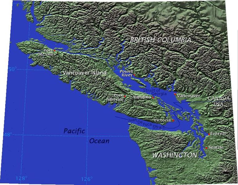
Mapa + Description: Shaded-relief map of Vancouver Island and neighboring parts of British Columbia and Washington State.
- Caption: Vancouver Island is separated from mainland British Columbia, Canada, by the Strait of Georgia and Queen Charlotte Strait, and from Washington state by the Strait of Juan de Fuca. Equidistant conic projection.
- Disclaimer: Do not rely on this map to determine the precise location of the international border.
- Author: created for Wikipedia by Kbh3rd
- on September 3, 2004, from GTOPO30 data archive copy at the Wayback Machine.
+ pochází z Wikimedia Commons, kde má status – Permission is granted to copy, distribute and/or modify this document under the terms of the GNU Free Documentation License, Version 1.2 or any later version published by the Free Software Foundation; with no Invariant Sections, no Front-Cover Texts, and no Back-Cover Texts.
Historie souboru
Kliknutím na datum a čas se zobrazí tehdejší verze souboru.
| Datum a čas | Náhled | Rozměry | Uživatel | Komentář | |
|---|---|---|---|---|---|
| současná | 18. 10. 2013, 09:46 |  | 866×673 (154 kB) | Sysop (diskuse | příspěvky) | (Fotografie + Sysop + pochází z Wikimedia Commons, kde má status – ) |
- Editovat tento soubor v externím programu (Více informací najdete v nápovědě pro nastavení.)
Odkazy na soubor
Na soubor odkazuje tato stránka:
