Soubor:Soufriere Hills Kollaps.jpg
Z Multimediaexpo.cz
(Rozdíly mezi verzemi)
(MW1.15-Fotografie) |
(+ Doplnění) |
||
| Řádka 1: | Řádka 1: | ||
| - | + | Fotografie + English: February 11, 2010, Soufrière Hills Volcano on the Caribbean island of Montserrat experienced a partial dome collapse. Moderate Resolution Imaging Spectroradiometer (MODIS) on NASA’s Aqua satellite. | |
| + | * Deutsch: Satellitenbild des Kollapses eines Lavadomes, Soufrière Hills, Montserrat, am 11. Februar 2010. Aufnahme vom Moderate Resolution Imaging Spectroradiometer (MODIS), Aqua Satellit. | ||
| + | * Date: 11. Febraury 2010 | ||
| + | * Source: NASA Earth Observatory | ||
| + | * Author: NASA Earth Observatory & Upload by Gunnar Ries Amphibol | ||
| + | |||
| + | + pochází z Wikimedia Commons, kde má status – Creative Commons Attribution-Share Alike 3.0 Unported. | ||
| + | |||
| + | [[Kategorie:CC fotografie]] | ||
Aktuální verze z 7. 10. 2014, 07:28
Fotografie + English: February 11, 2010, Soufrière Hills Volcano on the Caribbean island of Montserrat experienced a partial dome collapse. Moderate Resolution Imaging Spectroradiometer (MODIS) on NASA’s Aqua satellite.
- Deutsch: Satellitenbild des Kollapses eines Lavadomes, Soufrière Hills, Montserrat, am 11. Februar 2010. Aufnahme vom Moderate Resolution Imaging Spectroradiometer (MODIS), Aqua Satellit.
- Date: 11. Febraury 2010
- Source: NASA Earth Observatory
- Author: NASA Earth Observatory & Upload by Gunnar Ries Amphibol
+ pochází z Wikimedia Commons, kde má status – Creative Commons Attribution-Share Alike 3.0 Unported.
Historie souboru
Kliknutím na datum a čas se zobrazí tehdejší verze souboru.
| Datum a čas | Náhled | Rozměry | Uživatel | Komentář | |
|---|---|---|---|---|---|
| současná | 5. 4. 2014, 20:00 | 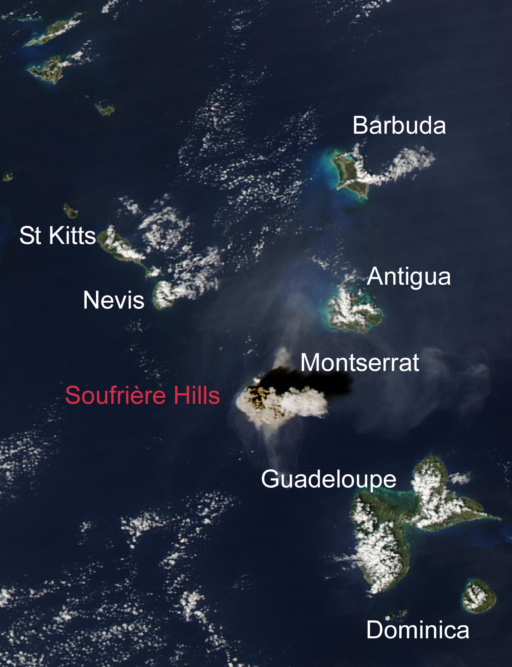 | 2 048×2 671 (362 kB) | Sysop (diskuse | příspěvky) | (MW1.15-Fotografie) |
- Editovat tento soubor v externím programu (Více informací najdete v nápovědě pro nastavení.)
Odkazy na soubor
Na soubor odkazuje tato stránka:


