V pondělí 16. září 2024 začala naše další
nová soutěž o nejlepší webovou stránku !!
Proto neváhejte a začněte rychle soutěžit o lákavé ceny !!
nová soutěž o nejlepší webovou stránku !!
Proto neváhejte a začněte rychle soutěžit o lákavé ceny !!
Soubor:Barents Sea map.png
Z Multimediaexpo.cz
(Rozdíly mezi verzemi)
m (Nahrazení textu „MW1.15-Fotografie“ textem „Fotografie + + pochází z Wikimedia Commons, kde má status – Kategorie:CC fotografie Kategorie:Fotografie soutěže 2015“) |
(++) |
||
| Řádka 1: | Řádka 1: | ||
| - | + | Mapa + Description: | |
| + | * English: The location of the Barents Sea north of Russia and Norway, and the surrounding seas and islands. Also includes political borders with their corresponding nation-states listed. | ||
| + | * Date: 25 November 2005, 16:40 | ||
| + | * Author: NormanEinstein | ||
| - | + | {{GFDL}} | |
| - | + | [[Kategorie:Maps of Russia]] | |
| - | [[Kategorie: | + | [[Kategorie:Maps of Norway]] |
| - | [[Kategorie: | + | [[Kategorie:Maps of Sweden]] |
Aktuální verze z 4. 12. 2021, 12:21
Mapa + Description:
- English: The location of the Barents Sea north of Russia and Norway, and the surrounding seas and islands. Also includes political borders with their corresponding nation-states listed.
- Date: 25 November 2005, 16:40
- Author: NormanEinstein
+ pochází z Wikimedia Commons, kde má status – Permission is granted to copy, distribute and/or modify this document under the terms of the GNU Free Documentation License, Version 1.2 or any later version published by the Free Software Foundation; with no Invariant Sections, no Front-Cover Texts, and no Back-Cover Texts.
Historie souboru
Kliknutím na datum a čas se zobrazí tehdejší verze souboru.
| Datum a čas | Náhled | Rozměry | Uživatel | Komentář | |
|---|---|---|---|---|---|
| současná | 17. 4. 2014, 07:32 | 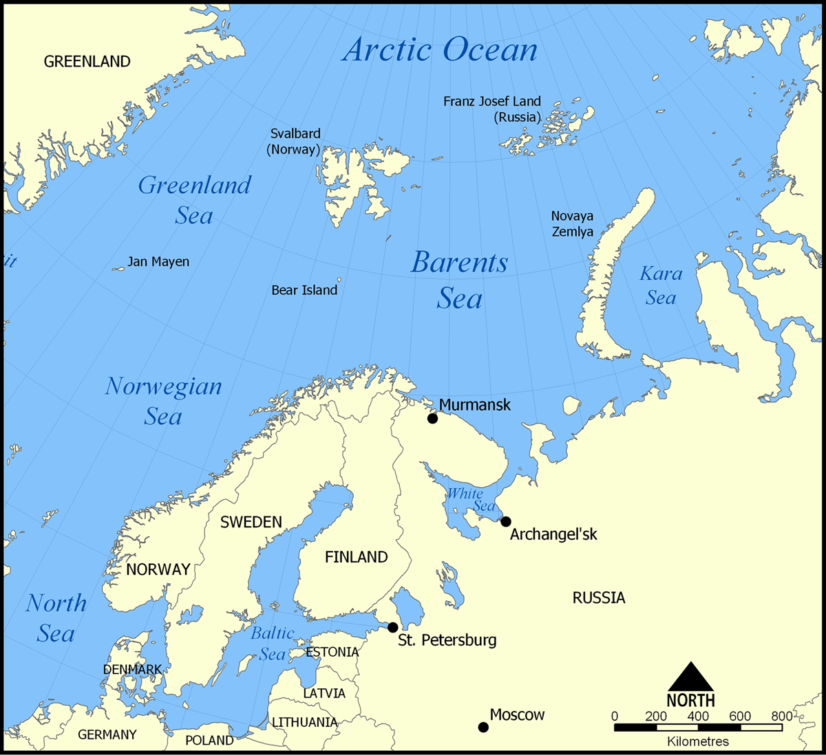 | 1 200×1 098 (680 kB) | Sysop (diskuse | příspěvky) | (MW1.15-Fotografie) |
- Editovat tento soubor v externím programu (Více informací najdete v nápovědě pro nastavení.)
Odkazy na soubor
Na soubor odkazují tyto 2 stránky:


