Soubor:Spice Islands (Zanzibar highlighted).png
Z Multimediaexpo.cz
(Rozdíly mezi verzemi)
(Mapa + Kategorie:Maps of Tanzania) |
(++) |
||
| Řádka 1: | Řádka 1: | ||
| - | Mapa + | + | Mapa + Description: Part of the map of Tanzania, showing the Spice Islands, and highlighting Zanzibar. |
| - | + | * Date: 28 May 2006 | |
| + | * Source: Vectors self-made in Inkscape. Source was cropped from 2003 Political map of Tanzania at Perry-Castañeda Library Map Collection — Tanzania. | ||
| + | ** The maps are attributed to the US Central Intelligence Agency. | ||
| + | * Author: Mysid | ||
| + | {{PD-self}} | ||
[[Kategorie:Maps of Tanzania]] | [[Kategorie:Maps of Tanzania]] | ||
Aktuální verze z 25. 11. 2020, 11:58
Mapa + Description: Part of the map of Tanzania, showing the Spice Islands, and highlighting Zanzibar.
- Date: 28 May 2006
- Source: Vectors self-made in Inkscape. Source was cropped from 2003 Political map of Tanzania at Perry-Castañeda Library Map Collection — Tanzania.
- The maps are attributed to the US Central Intelligence Agency.
- Author: Mysid
+ pochází z Wikimedia Commons, kde má status – I, the copyright holder of this work, release this work into the public domain. This applies worldwide.
Historie souboru
Kliknutím na datum a čas se zobrazí tehdejší verze souboru.
| Datum a čas | Náhled | Rozměry | Uživatel | Komentář | |
|---|---|---|---|---|---|
| současná | 25. 11. 2020, 11:28 | 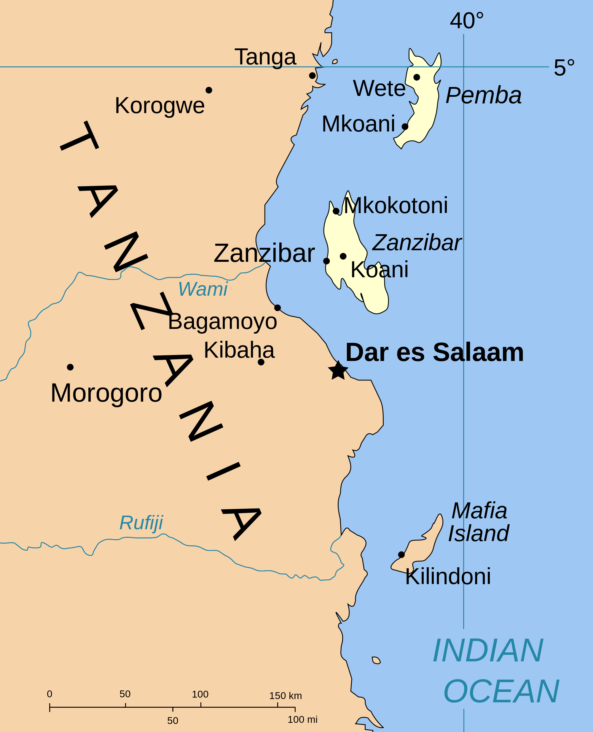 | 2 000×2 466 (317 kB) | Sysop (diskuse | příspěvky) | (Mapa + Kategorie:Maps of Tanzania) |
- Editovat tento soubor v externím programu (Více informací najdete v nápovědě pro nastavení.)
Odkazy na soubor
Na soubor odkazuje tato stránka:
.png&action=edit)
.png&action=history)
.png)
.png&oldid=1909116)
.png)
.png)
.png&action=edit&redlink=1)
.png&action=edit&oldid=1909116)
.png&oldid=1909104)
.png&action=edit&oldid=1909104)
.png&diff=prev&oldid=1909104)
.png&action=edit&externaledit=true&mode=file)
.png)