Soubor:Map sahel 2.png
Z Multimediaexpo.cz
(Rozdíly mezi verzemi)
(Fotografie +) |
(++) |
||
| Řádka 1: | Řádka 1: | ||
| - | + | Mapa + Description: | |
| + | * English: Map of Africa showing the Sahel highlighted in orange. | ||
| + | * Date: 30 June 2013 | ||
| + | Source: | ||
| + | * English: created by myself based on the existing Sahel Map in jpg format using Blank Map-Africa.svg showing also borders of South Sudan. | ||
| + | * Map was created using: | ||
| + | ** Sahel Map | ||
| + | ** Blank Map-Africa.svg | ||
| + | * Author: Pechristener | ||
| + | ** Sahel Map: King | ||
| + | |||
| + | {{GFDL}} | ||
| + | [[Kategorie:Mapy světa PNG]] | ||
Aktuální verze z 6. 8. 2023, 11:10
Mapa + Description:
- English: Map of Africa showing the Sahel highlighted in orange.
- Date: 30 June 2013
Source:
- English: created by myself based on the existing Sahel Map in jpg format using Blank Map-Africa.svg showing also borders of South Sudan.
- Map was created using:
- Sahel Map
- Blank Map-Africa.svg
- Author: Pechristener
- Sahel Map: King
+ pochází z Wikimedia Commons, kde má status – Permission is granted to copy, distribute and/or modify this document under the terms of the GNU Free Documentation License, Version 1.2 or any later version published by the Free Software Foundation; with no Invariant Sections, no Front-Cover Texts, and no Back-Cover Texts.
Historie souboru
Kliknutím na datum a čas se zobrazí tehdejší verze souboru.
| Datum a čas | Náhled | Rozměry | Uživatel | Komentář | |
|---|---|---|---|---|---|
| současná | 6. 8. 2023, 10:07 | 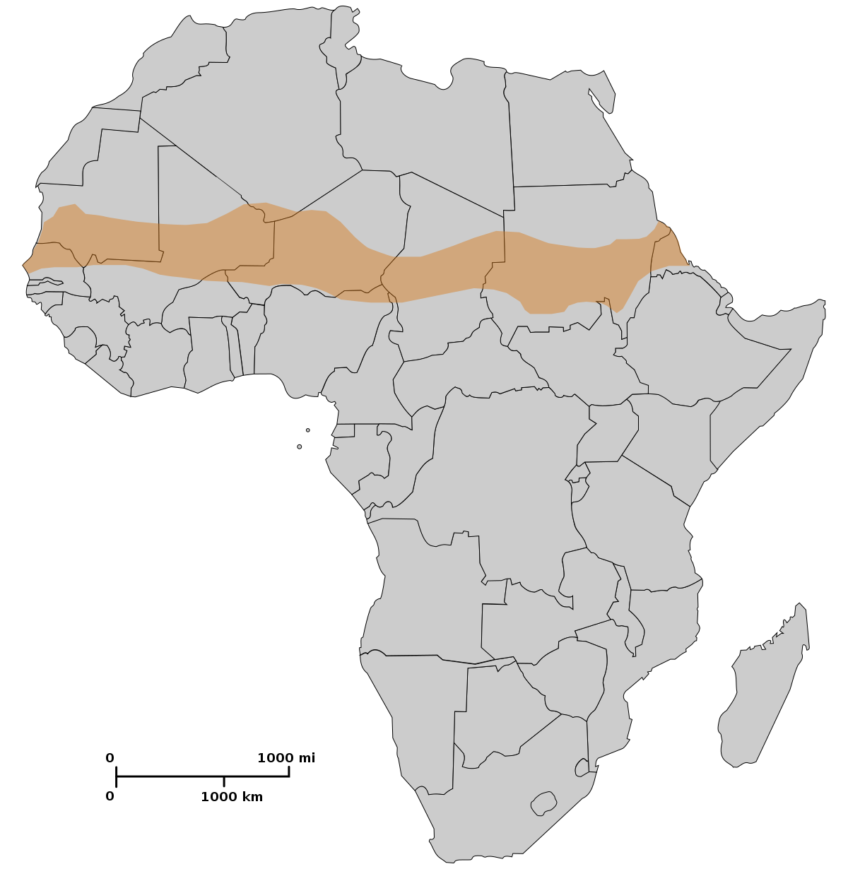 | 1 200×1 230 (189 kB) | Sysop (diskuse | příspěvky) | (Fotografie + ) |
- Editovat tento soubor v externím programu (Více informací najdete v nápovědě pro nastavení.)
Odkazy na soubor
Na soubor odkazuje tato stránka:


