Soubor:Ursus arctos range map.png
Z Multimediaexpo.cz
(Rozdíly mezi verzemi)
(Fotografie +) |
(+ Doplnění) |
||
| Řádka 1: | Řádka 1: | ||
| - | + | Mapa + Description: | |
| + | * English: Geographic distribution of Brown Bear (Ursus arctos). | ||
| + | * Date: 11 December 2010 | ||
| + | * Source: Put together by User:Hannu. | ||
| + | ** Base map: File:Worldmap location NED 50m.svg (Natural Earth Data) | ||
| + | * Author: User:Hannu & IUCN (International Union for Conservation of Nature) | ||
| + | |||
| + | + pochází z Wikimedia Commons, kde má status – This file is licensed under the Creative Commons Attribution-Share Alike 3.0 Unported license. | ||
| + | |||
| + | [[Kategorie:CC fotografie]] | ||
| + | [[Kategorie:Mapy světa PNG]] | ||
Aktuální verze z 28. 2. 2019, 09:44
Mapa + Description:
- English: Geographic distribution of Brown Bear (Ursus arctos).
- Date: 11 December 2010
- Source: Put together by User:Hannu.
- Base map: File:Worldmap location NED 50m.svg (Natural Earth Data)
- Author: User:Hannu & IUCN (International Union for Conservation of Nature)
+ pochází z Wikimedia Commons, kde má status – This file is licensed under the Creative Commons Attribution-Share Alike 3.0 Unported license.
Historie souboru
Kliknutím na datum a čas se zobrazí tehdejší verze souboru.
| Datum a čas | Náhled | Rozměry | Uživatel | Komentář | |
|---|---|---|---|---|---|
| současná | 28. 2. 2019, 09:16 | 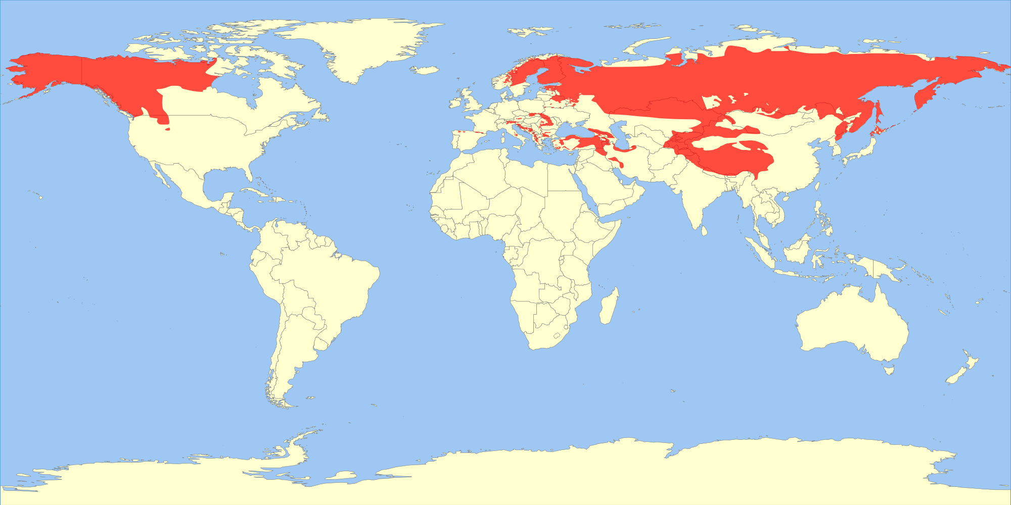 | 2 000×1 000 (383 kB) | Sysop (diskuse | příspěvky) | (Fotografie + ) |
- Editovat tento soubor v externím programu (Více informací najdete v nápovědě pro nastavení.)
Odkazy na soubor
Na soubor odkazuje tato stránka:


