Soubor:Tarn-et-Garonne-routes.png
Z Multimediaexpo.cz

Velikost tohoto náhledu je: 800 × 581 pixelů
Obrázek ve vyšším rozlišení (rozměr: 2 000 × 1 453 pixelů, velikost souboru: 2,67 MB, MIME typ: image/png)
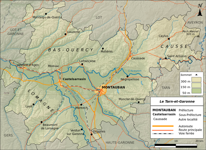
Mapa + Français : Carte topographique du Tarn-et-Garonne
- N: 44.399 S: 44.765 E: 2.002 O: 0.733
- Projection : IGN-GEOPORTALFXX (équirectangulaire)
- Relief : SRTM3v2
- Hydrographie : SIE Bassin Adour Garonne (mentions légales)
- Routes et Voies ferrées : IGN-ROUTE 500®
- Limites départementales : IGN-GEOFLA®
- Carte crée avec Qgis et Inkscape.
- Date: 1 March 2014, 23:00:32
- Author: Boldair
+ pochází z Wikimedia Commons, kde má status – Creative Commons Attribution-Share Alike 3.0 Unported license.
Historie souboru
Kliknutím na datum a čas se zobrazí tehdejší verze souboru.
| Datum a čas | Náhled | Rozměry | Uživatel | Komentář | |
|---|---|---|---|---|---|
| současná | 25. 3. 2015, 10:21 |  | 2 000×1 453 (2,67 MB) | Sysop (diskuse | příspěvky) | (Mapa + Français : Carte topographique du Tarn-et-Garonne * N: 44.399 S: 44.765 E: 2.002 O: 0.733 * Projection : IGN-GEOPORTALFXX (équirectangulaire) * Relief : SRTM3v2 * Hydrographie : SIE Bassin Adour Garonne (mentions légales) * Routes et Voies ferr�) |
- Editovat tento soubor v externím programu (Více informací najdete v nápovědě pro nastavení.)
Odkazy na soubor
Na soubor odkazuje tato stránka:
