Soubor:PIA02820.jpg
Z Multimediaexpo.cz
Velikost tohoto náhledu je: 800 × 554 pixelů
Obrázek ve vyšším rozlišení (rozměr: 4 000 × 2 769 pixelů, velikost souboru: 1,06 MB, MIME typ: image/jpeg)
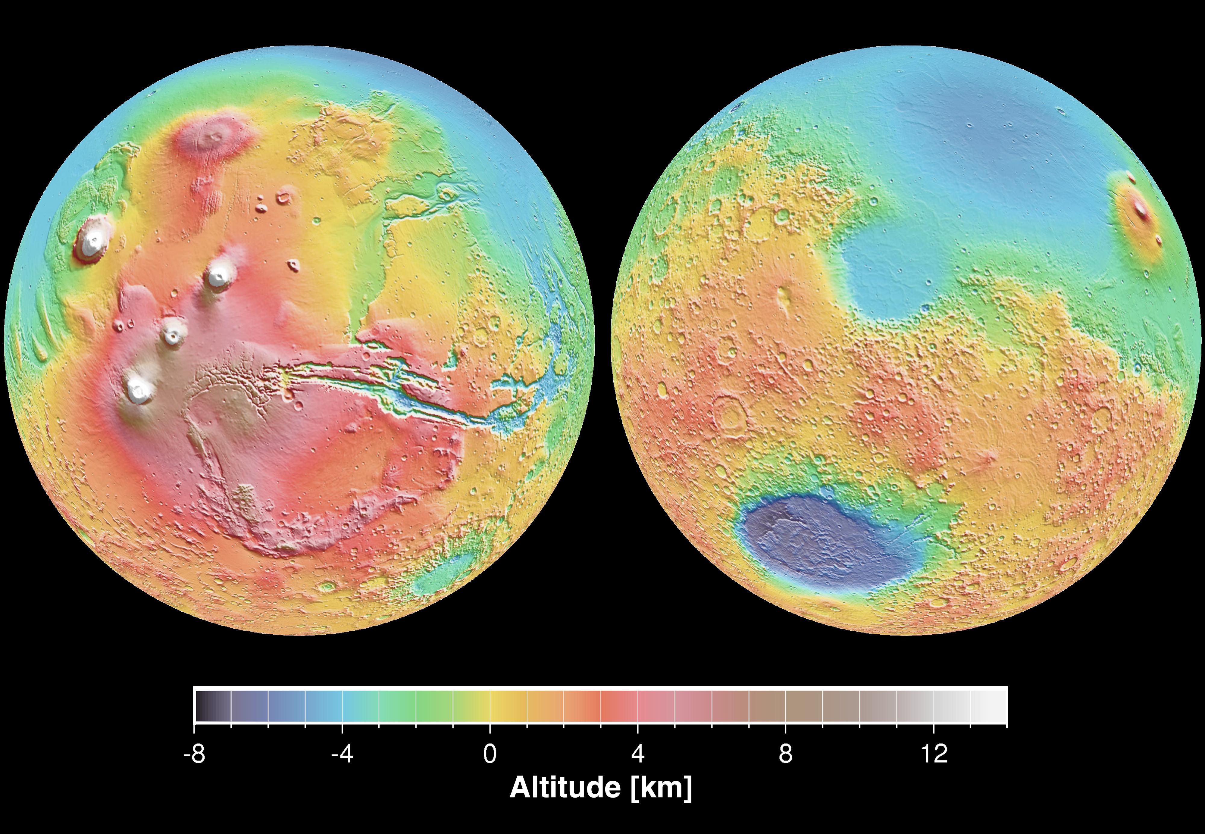
Fotografie + English: These maps are global false-color topographic views of Mars at different orientations from the Mars Orbiter Laser Altimeter (MOLA). The maps are orthographic projections that contain over 200,000,000 points and about 5,000,000 altimetric crossovers. The spatial resolution is about 15 kilometers at the equator and less at higher latitudes. The vertical accuracy is less than 5 meters. The right hand image view features the Hellas impact basin (in purple, with red annulus of high standing material). The left hand features the Tharsis topographic rise (in red and white). Note also the subtle textures associated with resurfacing of the northern hemisphere lowlands in the vicinity of the Utopia impact basin. This data was compiled by the Mars Orbiter Laser Altimeter (MOLA) Team, led by David Smith at the Goddard Space Flight Center in Greenbelt, MD.
- Español: Levantamento topográfico realizado pela sonda norte-americana Mars Global Surveyor
- Date: 17 January 2001
- Source: http://photojournal.jpl.nasa.gov/catalog/PIA02820
- Author: NASA/JPL
+ pochází z Wikimedia Commons, kde má status – This file is in the public domain because it was solely created by NASA. NASA copyright policy states that "NASA material is not protected by copyright unless noted".
Historie souboru
Kliknutím na datum a čas se zobrazí tehdejší verze souboru.
| Datum a čas | Náhled | Rozměry | Uživatel | Komentář | |
|---|---|---|---|---|---|
| současná | 20. 11. 2014, 10:01 | | 4 000×2 769 (1,06 MB) | Sysop (diskuse | příspěvky) | (Fotografie + + pochází z Wikimedia Commons, kde má status – ) |
- Editovat tento soubor v externím programu (Více informací najdete v nápovědě pro nastavení.)
Odkazy na soubor
Na soubor odkazuje tato stránka:


